TOPIC
Surface Features, Mountains, valleys, oceansMY PROGRESS
Pug Score
0%
Getting Started
"Let's build your foundation!"
Best Streak
0 in a row
Study Points
+0
Overview
Practice
Watch
Read
Quiz
Next Steps
Get Started
Get unlimited access to all videos, practice problems, and study tools.
BACK TO MENU
Topic Progress
Pug Score
0%
Getting Started
"Let's build your foundation!"
Videos Watched
0/0
Best Practice
No score
Read
Not viewed
Best Quiz
No attempts
Best Streak
0 in a row
Study Points
+0
Overview
Practice
Watch
Read
Quiz
Next Steps
Read
Explore Earth's Surface Features: Mountains, Valleys, and Oceans
You will explore Earth's major surface features mountains, valleys, oceans, and more and discover how powerful forces like plate movement, erosion, and volcanic activity shape the land and ocean floor.
What Are Earth's Surface Features?
When you look at Earth from space, you can see mountains, flat lands, and vast blue oceans. These are called surface features or landforms the shapes that make up Earth's outer layer, the crust. You can learn about Earth's internal layers in Internal Structure: Layers of the Earth.
Earth's surface is always changing. Forces like tectonic plate movement, volcanic activity, and erosion work together to build up and wear down the land over millions of years.
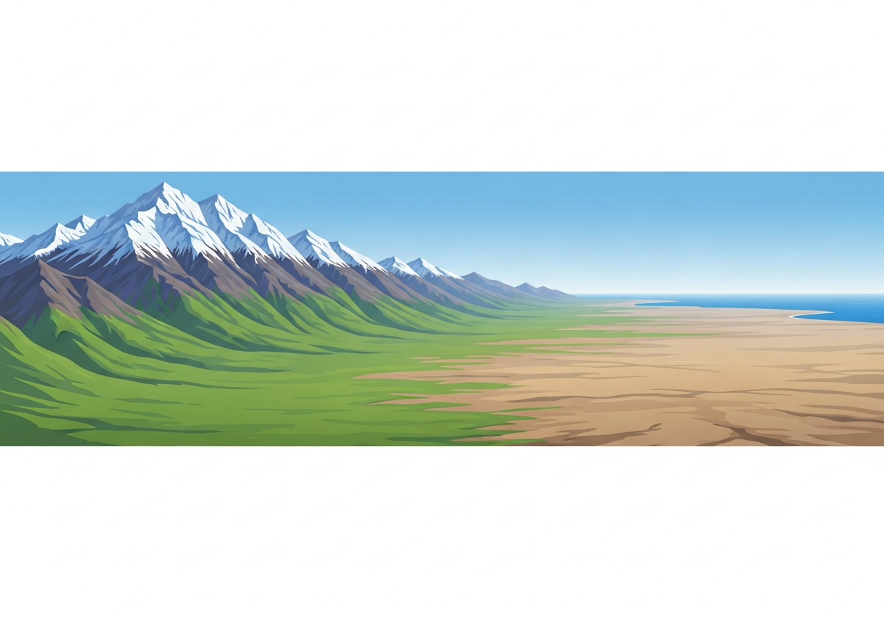
Land Surface Features
Mountains
A mountain rises steeply to a high elevation above the land around it. Most mountains form when large sections of Earth's crust push together and fold upward these are called fold mountains. When a block of rock is pushed up along a crack in the crust, it forms a fault-block mountain. Volcanic mountains form when lava builds up and hardens over many eruptions.
Mountains are colder at the top because air gets thinner and holds less heat as altitude increases.
Valleys
A valley is a low area of land that sits between hills or mountains. River valleys form when flowing water slowly wears away rock and soil over thousands of years. Glaciers carve wide, U-shaped valleys as heavy ice grinds through rock.
Canyons
A canyon is a deep, narrow valley with steep walls cut into rock, often carved by a river over millions of years. The Grand Canyon is a famous example.
Plains
A plain is a large, flat area of land at a low elevation. Plains often form when rivers deposit layers of sediment tiny pieces of rock, sand, and soil over long periods of time.
Plateaus
A plateau is a large, flat area of land raised high above the surroundings. It is flat on top like a plain, but sits at a high elevation like a mountain.
Ocean Surface Features
The ocean covers about 71% of Earth's surface, making it the largest feature on our planet. Earth has five major oceans: the Pacific (the largest and deepest), Atlantic, Indian, Southern, and Arctic Oceans. Ocean water is salty because rivers carry dissolved minerals from rocks on land into the ocean over millions of years.
The ocean floor has surface features just like dry land does. Near continents, the seafloor slopes gently this shallow zone is the continental shelf. Further out, the ocean gets much deeper. Ocean trenches are the deepest parts of the ocean, formed where tectonic plates collide and one sinks down. Seamounts are underwater volcanoes that never break the surface. Mid-ocean ridges are underwater mountain chains where plates pull apart and new seafloor forms.
You can explore how oceans support life by visiting Aquatic Biomes: Water-Based Ecosystem Types.
Forces That Shape Earth's Surface
Tectonic plates are giant, slow-moving sections of Earth's crust that float on the hot mantle below. When two plates collide, they can push rock upward to form mountains. When plates pull apart, they create mid-ocean ridges or rift valleys. The Ring of Fire is a zone of many volcanoes and earthquakes surrounding the Pacific Ocean, caused by tectonic plate activity.
A volcano is an opening in Earth's surface where hot melted rock escapes. Melted rock beneath Earth's surface is called magma. When magma reaches the surface, it is called lava. The Hawaiian Islands formed through repeated volcanic eruptions that built up layers of rock above the ocean floor.
Erosion is the process by which wind, water, and ice wear away and carry off pieces of Earth's surface. Glaciers large, slow-moving masses of thick ice also shape the land by carving valleys and moving sediment. You can learn more about how erosion and weathering work in Formation Processes: Erosion, Deposition, and Weathering.
The shape and features of the land surface in an area is called topography. Understanding topography helps scientists and people plan where to build cities, farms, and roads. People often settle in valleys because the land is flat, fertile, and close to water.
Key Terms and Definitions
Surface Features (Landforms): The shapes that make up Earth's outer surface, including mountains, valleys, plains, and ocean features.
Mountain: A landform that rises steeply to a high elevation above the surrounding land.
Valley: A low area of land that sits between hills or mountains, often formed by rivers or glaciers.
Canyon: A deep, narrow valley with steep rocky walls, usually carved by a river over millions of years.
Plain: A large, flat area of land at a low elevation, often formed by sediment deposits from rivers.
Plateau: A large, flat area of land raised high above the surrounding landscape flat on top but elevated.
Ocean: A very large, deep body of salt water covering about 71% of Earth's surface.
Continental Shelf: The shallow underwater edge of a continent near the coastline, before the ocean floor drops into deeper water.
Ocean Trench: The deepest parts of the ocean, formed where tectonic plates collide and one sinks beneath the other.
Seamount: An underwater volcano that rises from the ocean floor but never breaks the surface.
Mid-Ocean Ridge: An underwater mountain chain found in the middle of the ocean, where tectonic plates pull apart and new seafloor forms.
Tectonic Plates: Giant, slow-moving sections of Earth's crust that float on the mantle and cause earthquakes, volcanoes, and mountain formation when they move.
Crust: The thin, rocky outermost layer of Earth the surface you live on.
Mantle: The thick, hot middle layer of Earth located between the crust and the core.
Core: The center of Earth the outer core is liquid metal and the inner core is a solid ball of extremely hot metal.
Magma: Melted rock found beneath Earth's surface inside the mantle.
Lava: Hot, melted rock that has reached Earth's surface through a volcanic eruption.
Volcano: An opening in Earth's surface where hot melted rock, ash, and gases escape.
Erosion: The slow breaking down and carrying away of Earth's surface by wind, water, and ice.
Sediment: Tiny pieces of rock, sand, and soil carried and deposited by water or wind.
Glacier: A large, slow-moving mass of thick ice on land that carves valleys and moves sediment.
Fold Mountain: A mountain formed when tectonic plates collide and rock layers are squeezed and folded upward.
Fault-Block Mountain: A mountain formed when a large block of rock is pushed upward along a fault (crack) in Earth's crust.
Volcanic Mountain: A mountain formed when lava from repeated volcanic eruptions builds up and hardens into rock.
Ring of Fire: A zone of many volcanoes and earthquakes that surrounds the Pacific Ocean, caused by tectonic plate activity.
Topography: The shape and features of the land surface in a particular area.
Continental Shelf: The shallow, gently sloping underwater edge of a continent near the coastline.
Practice What You Know
You can practice identifying surface features by looking at maps and photographs of different landforms. Try to spot mountains, valleys, plains, and plateaus in pictures of real places around the world.
You can also compare land features to ocean floor features both have mountains (ridges and seamounts), valleys (trenches), and flat areas (abyssal plains). This comparison helps you see that Earth's surface continues to change beneath the ocean too. Explore how these features connect to Climate Regions: Temperature and Precipitation Patterns and Terrestrial Biomes: Land-Based Ecosystem Types.
Building on What You Already Know
Before exploring surface features, you should be familiar with Types of Landforms: Mountains, Valleys, and Plains and Formation Processes: Erosion, Deposition, and Weathering. These topics give you the foundation to understand how landforms are built and worn down.
You should also know about Changes Over Time: Rapid and Slow Changes, Rocks and Minerals: Properties and Classification, and Soil Composition: Components and Properties. Understanding Weather Patterns: Long-Term Weather Trends and Climate Zones: Regional Variations also helps you see how surface features affect the weather and climate of a region.
Related Topics and Connections
This topic connects to many other important science ideas. You already explored Internal Structure: Layers of the Earth understanding the crust, mantle, and core helps you explain why surface features form where they do.
Surface features directly affect living things. You can see this connection in Terrestrial Biomes: Land-Based Ecosystem Types and Aquatic Biomes: Water-Based Ecosystem Types, where mountains, valleys, and oceans create different environments for plants and animals. The Climate Regions: Temperature and Precipitation Patterns topic shows you how mountains and oceans influence climate around the world.
You can also explore how water, carbon, and nitrogen move through Earth's surface features in Matter Cycles: Water, Carbon, and Nitrogen Cycles.
After mastering surface features, you will be ready to dive deeper into Rock Types: Igneous, Sedimentary, and Metamorphic, Rock Cycle: Formation and Transformation, and Mineral Properties: Physical and Chemical Properties all of which build directly on what you learn here about how Earth's surface is made and changed.